
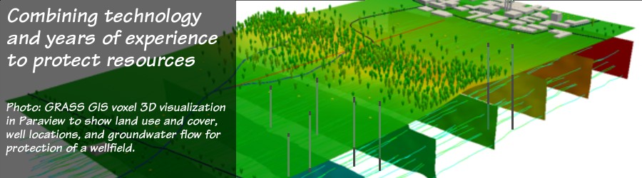
Pictou Landing water supply
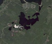
Pictou Landing is a Mi'kmaq First Nation Community of about 400 located on the north shore of Nova Scotia. The community is situated on a peninsula, with salt water of the Northumberland Strait to the north and the former Boat Harbour tidal estuary to the south. Years ago, a dam was built across the outlet of the estuary so it could serve as a stabilization lagoon for effluent from a nearby bleached kraft pulp mill. This created a number of environmental concerns both on land and with the well water supply on the peninsula.
 As part of the
planning and community compensation process to decommission the lagoon,
the Federal Department of
Indian Affairs hired earth-water Concepts inc. staff to assess the
level of impact the lagoon may have had on the land and water
supply at Pictou Landing, and to assess the affects that community
growth and returning salt water to Boat Harbour might have on the water
supply.
A comprehensive investigation was carried out that included:
As part of the
planning and community compensation process to decommission the lagoon,
the Federal Department of
Indian Affairs hired earth-water Concepts inc. staff to assess the
level of impact the lagoon may have had on the land and water
supply at Pictou Landing, and to assess the affects that community
growth and returning salt water to Boat Harbour might have on the water
supply.
A comprehensive investigation was carried out that included:
 To offset the water shortage caused by the well failure, water was being
trucked to the site at considerable cost to the
community. Therefore, an emergency call was made for earth-water Concepts inc.
to return to the site to obtain a new water supply.
That work involved:
To offset the water shortage caused by the well failure, water was being
trucked to the site at considerable cost to the
community. Therefore, an emergency call was made for earth-water Concepts inc.
to return to the site to obtain a new water supply.
That work involved:
Pictou Landing is a Mi'kmaq First Nation Community of about 400 located on the north shore of Nova Scotia. The community is situated on a peninsula, with salt water of the Northumberland Strait to the north and the former Boat Harbour tidal estuary to the south. Years ago, a dam was built across the outlet of the estuary so it could serve as a stabilization lagoon for effluent from a nearby bleached kraft pulp mill. This created a number of environmental concerns both on land and with the well water supply on the peninsula.
As part of the
planning and community compensation process to decommission the lagoon,
the Federal Department of
Indian Affairs hired earth-water Concepts inc. staff to assess the
level of impact the lagoon may have had on the land and water
supply at Pictou Landing, and to assess the affects that community
growth and returning salt water to Boat Harbour might have on the water
supply.
A comprehensive investigation was carried out that included:- a soil geochemical survey of the entire community and to the north shore of the lagoon,
- water quality testing of the water supply over an extended period,
- laboratory testing of soil and water samples for numerous inorganic and organic parameters down to part per quadrillion levels,
- pumping tests of the water supply wells located within the community to characterize the hydrology of the aquifer,
- determination of solute migration times though the aquifer both from the lagoon to the south, and from the ocean to the north,
- design of a nested groundwater monitoring well system to further characterize the local physical and chemical hydrogeology,
-
design of an expanded water supply system off-peninsula that would reduce point drawdown
stresses from the existing wells and serve as a backup or main water supply in case of lagoon
water or sea water breakthrough into the existing water supply wells.
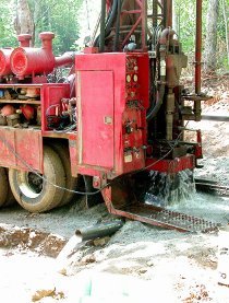
To offset the water shortage caused by the well failure, water was being
trucked to the site at considerable cost to the
community. Therefore, an emergency call was made for earth-water Concepts inc.
to return to the site to obtain a new water supply.
That work involved:- drilling two new wells, each of them able to meet full community demand so as to provide contingency and backup capacity,
- conducting pumping tests on the two new wells,
- designing pumping schemes that would not allow the new wells to be over-pumped while reducing the impact potential from Boat Harbour,
- recommendations that proper hydrogeological analysis be done of the monitoring well data that has been collected by others, and
- recommendations for the design and implementation of a proper well field and water source protection program.
Canadian Springs water bottlers
The Sparkling Spring Water Ltd. bottling company, now operating under the name Canadian Springs Water, hired earth-water Concepts inc. to upgrade their well water supply. Their Atlantic Canadian bottling plant is located at Valley, in central Nova Scotia.
Water production at the plant site is from the Triassic age Wolfville Formation sandstone, where deeper commercial wells are capable of yields between 50 and 200 igpm. Sparkling Spring Water was growing and needed to increase both the amount of supply for the plant, and the level of supply protection.
 earth-water Concepts inc. performed a comprehensive groundwater investigation that included:
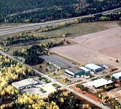
Debert Industrial Park
The Debert Air Industrial Park is located on the former lands of Canadian Forces Station Camp Debert in central Nova Scotia. The industrial park obtains its water from a number of wells drilled into the unconfined Triassic age Wolfville Formation. Individual wells at the park have long-term yields that range from 100 to 1,000 US gpm.
 While twinning the section of the Trans-Canada highway that passes just
south of the industrial park, a large volume of grubbing debris was
buried, causing a drop in subsurface redox conditions and seriously
impacting water quality at one of the industrial park's major water production wells.
While twinning the section of the Trans-Canada highway that passes just
south of the industrial park, a large volume of grubbing debris was
buried, causing a drop in subsurface redox conditions and seriously
impacting water quality at one of the industrial park's major water production wells.
The Nova Scotia Department of Public Works hired earth-water Concepts inc. staff to investigate the cause and nature of the water quality decline, to assess whether other wells in the industrial park might also become affected by the buried debris, and to recommend best locations for replacement water supply.
The investigation included hydrogeologic mapping to identify possible locations for new supply; groundwater modelling; and delineation of solute flow paths and 0.25, 0.5, 1, 2, 3, 6 and 10 year time-of-travel capture zones -- for the affected well to confirm the cause of the problem, for all other existing wells, and for several hypothetical replacement well locations as a means of defining the best locations to drill for replacement supply.
A new water supply well was installed by others at one of the primary location recommended by our assessment. That well was put in service and continues to serve as the main water production well for the Debert Air Industrial Park.
The Sparkling Spring Water Ltd. bottling company, now operating under the name Canadian Springs Water, hired earth-water Concepts inc. to upgrade their well water supply. Their Atlantic Canadian bottling plant is located at Valley, in central Nova Scotia.
Water production at the plant site is from the Triassic age Wolfville Formation sandstone, where deeper commercial wells are capable of yields between 50 and 200 igpm. Sparkling Spring Water was growing and needed to increase both the amount of supply for the plant, and the level of supply protection.
earth-water Concepts inc. performed a comprehensive groundwater investigation that included:
- hydrogeologic mapping to select best locations on client lands for additional supply,
- field surveys to inventory possible contamination sources within likely zones of influence,
- aquifer vulnerability determinations using DRASTIC,
- preliminary groundwater modelling to determine solute migration paths and times of travel as a means of assessing the viability of protecting the proposed new supply locations,
- drilling for new supply, pumping tests, hydrogeological analysis, and additional groundwater modelling to confirm the preliminary groundwater modelling results,
- delineating solute migration paths and 1, 2, 5 and 10 year time-of-travel capture zones for the new water supply wells,
- defining best management practices for the new sources and for surrounding land use.
Debert Industrial Park
The Debert Air Industrial Park is located on the former lands of Canadian Forces Station Camp Debert in central Nova Scotia. The industrial park obtains its water from a number of wells drilled into the unconfined Triassic age Wolfville Formation. Individual wells at the park have long-term yields that range from 100 to 1,000 US gpm.
While twinning the section of the Trans-Canada highway that passes just
south of the industrial park, a large volume of grubbing debris was
buried, causing a drop in subsurface redox conditions and seriously
impacting water quality at one of the industrial park's major water production wells.The Nova Scotia Department of Public Works hired earth-water Concepts inc. staff to investigate the cause and nature of the water quality decline, to assess whether other wells in the industrial park might also become affected by the buried debris, and to recommend best locations for replacement water supply.
The investigation included hydrogeologic mapping to identify possible locations for new supply; groundwater modelling; and delineation of solute flow paths and 0.25, 0.5, 1, 2, 3, 6 and 10 year time-of-travel capture zones -- for the affected well to confirm the cause of the problem, for all other existing wells, and for several hypothetical replacement well locations as a means of defining the best locations to drill for replacement supply.
A new water supply well was installed by others at one of the primary location recommended by our assessment. That well was put in service and continues to serve as the main water production well for the Debert Air Industrial Park.

